
Geospatial & Survey
- Cadastral Survey,
- Oil pipeline/ oil location survey and planning
- Route survey and planning
- Topographical survey
- Oil, gas and general pipelines and location surveys
- QA/QC Services
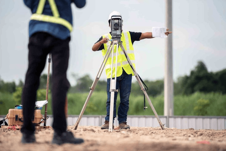
- Mapping, Engineering Survey, GIS Mapping
- Drone Survey
Cadastray Survey
A cadastral survey is the process of identifying, measuring, and officially recording land boundaries and parcel ownership to establish legal property rights. Cadastral surveying is important because it establish legal ownerships, Prevents Boundary Conflicts.
Supports Land Registration, Facilitates Development and Planning and Promotes Sustainable Land Use. Looking for a reliable Cadastral Surveyor you can trust? Your land deserves accuracy, clarity, and legal security—Contact Us Today!
Route survey and planning
It is the systematic process of identifying and planning the most suitable route between two or more points, ensuring efficiency, safety, and cost-effectiveness. Route survey and planning involves the collection and analysis of spatial data using surveying methods and tools like Geographic Information Systems (GIS), remote sensing, and topographic mapping to determine optimal alignment while considering terrain, environmental, and engineering constraints.
Oil Pipeline and Location Survey Services
Oil pipeline / oil location survey and planning refers to the process of collecting accurate land, environmental, and geographic data to determine the best routes and locations for oil pipelines and related infrastructure—and then designing how those pipelines will be built and managed
We deliver reliable data that supports safe, cost-effective, and regulation-compliant projects. From initial route selection to final mapping, every stage is handled with precision
QA/QC Services
Through testing, audits, and inspections, QA/QC (Quality Assurance/Quality Control) services guarantee that projects, goods, and procedures adhere to safety, legal, and contractual requirements. Non-destructive testing (NDT), welding inspections, coating checks, and vendor audits are important services that are commonly utilized in the manufacturing, construction, and oil and gas industries to prevent faults
Land Mapping
Land Mapping in surveying is the process of measuring, identifying, and creating detailed representations of land features, boundaries, and positions on the earth’s surface.
It involves collecting accurate data about land areas using tools like GPS, drones, total stations, and GIS software to produce maps used for planning, construction, property documentation, and development.
GIS MAPPING
GIS Mapping refers to the creation and analysis of maps using digital tools that capture, store, and display spatial (location-based) data. The importance of GIS Mapping lies in its ability to collect, analyze, and visualize location-based data using Geographic Information Systems (GIS), helping individuals and organizations make informed decisions
Drone survey
Is a modern surveying method that uses unmanned aerial vehicles (UAVs) to capture high-resolution images and spatial data of land from the air. In simple terms, a drone survey provides a quick, accurate, and efficient way to capture land data from above.
A Topographical survey
Is the process of measuring and mapping the physical features of land—such as hills, valleys, rivers, roads, and buildings. It is a detailed survey that collects elevation data and spatial coordinates to produce maps showing contours, levels, and surface features, often using tools like total stations, GPS, and Geographic Information Systems (GIS) for analysis and visualization.